ND · Theodore Roosevelt National Park · Completed
Sagebrush Slaughter on the Achenbach Loop
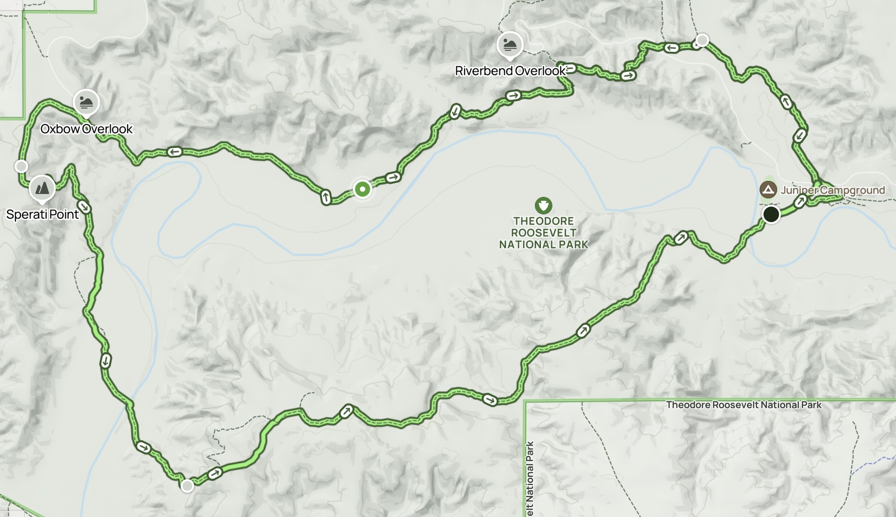
Achenbach, North Achenbach and Buckhorn Trail Loop
Trail notes
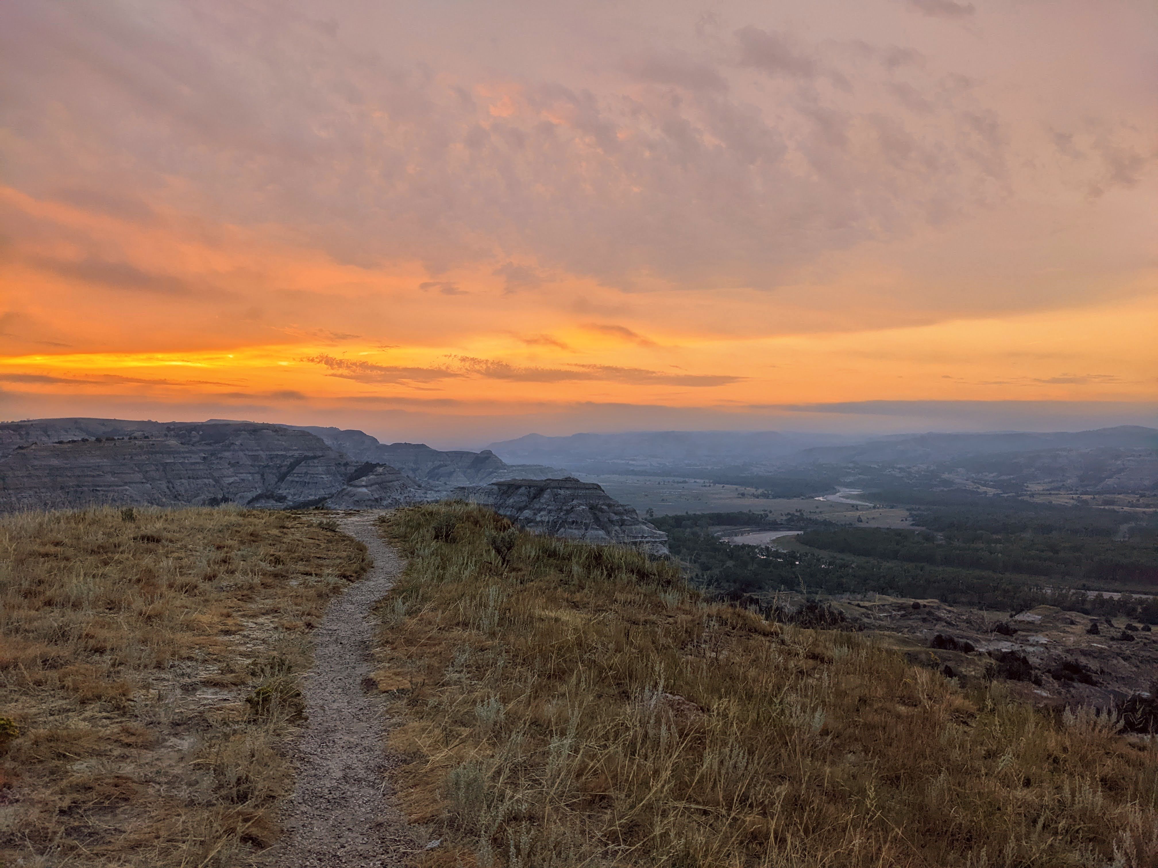
A fast solo endurance hike through the Achenbach, North Achenbach, and Buckhorn loop. The biggest views came early near Oxbow at sunrise; the rest became more about pushing through the valley, managing water, avoiding navigation mistakes, and surviving sagebrush in shorts.
Conditions: Started at Oxbow Overlook around sunrise. River crossings were manageable at the time, with muddy/slippery banks. Exposed terrain and limited water were major concerns.
Route highlights
- Oxbow Overlook Start — Started at Oxbow Overlook. This was also the best scenic payoff area, especially at sunrise.
- Drop into the Valley — After leaving the elevated start, the route drops down and loses much of the view advantage.
- Juniper Refill — Water was refilled at Juniper. This was important because 3 liters was still challenging toward the end.
- River Crossings — Two crossings were manageable at the time but involved muddy/slippery banks and shin-to-knee-high water.
Official vs. Turner Recording
| Detail | Official / AllTrails | Turner Recording |
|---|---|---|
| Trail name | Achenbach, North Achenbach and Buckhorn Trail Loop | Sagebrush Slaughter on the Achenbach Loop |
| Area | Theodore Roosevelt National Park, ND | Theodore Roosevelt National Park, ND |
| Land manager | National Park Service | Same trail area |
| Route | Loop | Completed route |
| Difficulty / family fit | Hard | Adult endurance |
| Distance | 18.1 mi | 20.7 mi |
| Elevation gain | 2,391 ft gain | 2,572 ft gain |
| Time | 8 hr 15 min | 7 hr 2 min total · 6 hr 27 min moving |
| Date | Not applicable | Aug 13, 2022 |
After Action Report
Field report
Why did we choose this hike?
I was at Minot AFB for a short work trip, and this was the closest substantial hike I could find that I could potentially complete in one day.
Who went and what did each person wear/carry?
Clay completed the hike solo. He wore a rabbit Nine Trails race T-shirt, Patagonia Hydrolock Boardshorts, Drymax socks, and Hoka Speedgoat 5 trail runners—their first hike. He carried an Ozark Trail 14L Adult Juniper Daypack Backpack with a separately purchased hydration bladder and two HydraPak soft-sided water bottles. He also brought Birkenstocks for the river crossings.
When did we go and what were the conditions?
The hike was in August 2022. The morning began cool, then warmed through the afternoon. Conditions were very good overall, but the final stretch became long and hot, making water an important factor.
Where did we start, which direction did we go, and how long did it take?
I started at Oxbow Overlook and hiked the loop counterclockwise. The trip took roughly seven hours.
What was the route actually like?
The route was well maintained for most of the hike. Navigation became difficult near the end in the sagebrush. The first half had the best views and was the most enjoyable part; the final valley section became a slog through sagebrush with limited scenic payoff.
What was the biggest scenic payoff?
The best views were near Oxbow at the start. There were several expansive park views during the first half of the hike, but the strongest scenic payoff was at the beginning.
What was the hardest part?
The hardest part was the overall length as a single-day hike and the limited access to water refill spots. The sagebrush near the end also made navigation difficult.
What gear mattered most?
The hydration bladder and extra water bottles mattered most. Pants also would have been a better choice than boardshorts for the sagebrush.
What food and water did we bring/use?
I started with my hydration bladder and extra soft water bottles filled, then refilled at Juniper Campground. I also carried a few Nature Valley granola bars and bags of gummy bears. I generally do not eat much while hiking.
Is this good for kids/families?
Families could hike the first half to Juniper at a slow pace, but there may not be enough payoff to justify it. A better family option would be camping at Juniper and taking short excursions from there, or driving to Oxbow to enjoy the views.
What section would we repeat or skip?
If I returned, I would only do the first half, if any. I would rather spend more time near Oxbow at the top of the valley and enjoy the views there.
What would we do differently next time?
I would wear pants and bring extra water. Once I reached Juniper, I would walk the road back to Oxbow rather than continue the full loop.
Would we do it again?
I would probably not do the full loop again unless I specifically wanted a challenging, long day hike.
Turner Tornado verdict.
Good for a single-day challenge; otherwise, I would stick to the roads and campgrounds.
Route map